2022 Map of Van Horne
USGS Topo · Published 2022About this map
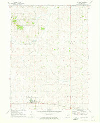
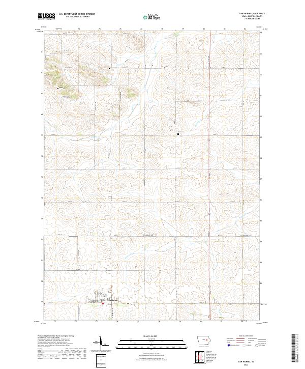
Van Horne sits at the junction of Co Trunk Rd E44 and Co Trunk Hwy V66, serving as a primary settlement node in this section of Benton County. The surrounding landscape is defined by a systematic grid of section roads and several notable local watercourses, including Mud Cr and Wildcat Cr. Genealogical interest is centered on three distinct burial sites: Big Grove Cem in the north, Indian Cem to the west, and Bellar Cem further east. These landmarks, along with named drainage like Opossum Cr, illustrate the rural development and land use patterns of the early 21st century. The map provides a clear look at the intersection of agriculture and small-town infrastructure, from the residential blocks of the village to the expansive rural routes like Co Hwy E30.
Find a feature on this map
27 named features on this map. Tap any name to fly to it.
Don’t see what you’re looking for? This feature index may not catch every label — zoom into the map to look around manually.
Map Details
Editions of this 2022 Van Horne Map
This is the sole edition of this map. No revisions or reprints were ever made.