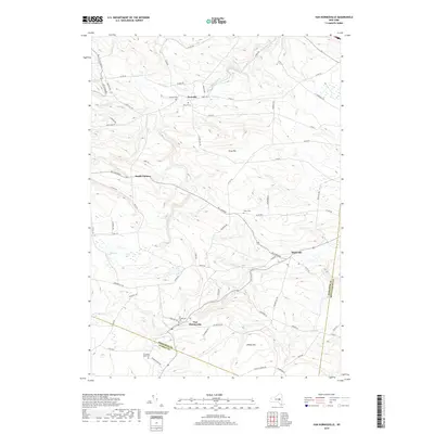
2019 Map of Van Hornesville
USGS Topo · Published 2019About this map
Van Hornesville and Starkville anchor this survey of the upland drainage divide where the headwaters of Otsquago Cr and Ohisa Cr originate. The settlement pattern reflects a deeply rooted rural landscape, where scattered hamlets like Newville and Smith Corners are connected by a network of county roads winding through significant elevations like Firey Hill and Willse Hill. For family historians, the map is remarkably dense with burial sites, including the Van Hornesville Cem, Pumpkin Hook Cem, and Hawn Cem. The terrain is defined by the sharp descents of Nowadaga Creek as it flows north toward the Mohawk valley. This 2019 edition maintains the record of these long-standing rural communities as they exist today along the boundaries of Herkimer, Montgomery, and Otsego counties.
Find a feature on this map
53 named features on this map. Tap any name to fly to it.
Don’t see what you’re looking for? This feature index may not catch every label — zoom into the map to look around manually.
Map Details
Editions of this 2019 Van Hornesville Map
This is the sole edition of this map. No revisions or reprints were ever made.
Other maps of this area

1898 · Canajoharie
USGS Topo · 1:62,500

1900 · Little Falls
USGS Topo · 1:62,500

1900 · Canajoharie
USGS Topo · 1:62,500

1901 · Lassellsville
USGS Topo · 1:62,500

1902 · Canajoharie
USGS Topo · 1:62,500

1903 · Richfield Springs
USGS Topo · 1:62,500

1903 · Lassellsville
USGS Topo · 1:62,500

1903 · Little Falls
USGS Topo · 1:62,500

1939 · Little Falls
USGS Topo · 1:62,500

1943 · Jordanville
USGS Topo · 1:24,000