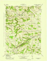
1945 Map of Van Hornesville
USGS Topo · Published 1945About this map
The confluence of Otsquago Creek and Ohisa Creek defines the landscape of southern Herkimer County in this mid-century survey. The settlement of Van Hornesville serves as a local hub near the State Fish Hatchery and Willse Hill, while the surrounding townships of Danube, Stark, and Springfield are marked by a dense network of country schools and family-named corners.
Find a feature on this map
35 named features on this map. Tap any name to fly to it.
Don’t see what you’re looking for? This feature index may not catch every label — zoom into the map to look around manually.
Map Details
Editions of this 1945 Van Hornesville Map
This is the sole edition of this map. No revisions or reprints were ever made.
Other maps of this area

1898 · Canajoharie
USGS Topo · 1:62,500

1900 · Little Falls
USGS Topo · 1:62,500

1900 · Canajoharie
USGS Topo · 1:62,500

1901 · Lassellsville
USGS Topo · 1:62,500

1902 · Canajoharie
USGS Topo · 1:62,500

1903 · Richfield Springs
USGS Topo · 1:62,500

1903 · Lassellsville
USGS Topo · 1:62,500

1903 · Little Falls
USGS Topo · 1:62,500

1939 · Little Falls
USGS Topo · 1:62,500

1943 · Jordanville
USGS Topo · 1:24,000