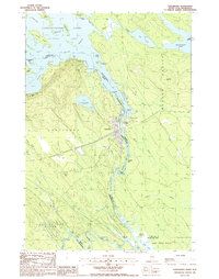
1988 Map of Vanceboro
USGS Topo · Published 1988About this map
Vanceboro sits at a critical international junction on the Maine-New Brunswick border, where the Canadian Pacific railroad crosses the St Croix River. The landscape is dominated by the complex waterways of the Chiputneticook Lakes, including the sprawling Spednic Lake and its many named points and islands like Nason Pt and Lindsay Island. The river itself is a focal point of activity and geography, characterized by a series of river rapids known locally as "rips," including Wingdam Rips, Elbow Rips, and Joe Georges Rips. This 1980s survey captures the borderland character of the region, where the town of St Croix and various Gravel Pits suggest a local economy tied to both the land and the transit corridor. South of the main settlement, the river meanders through The Horseshoe and past Porters Meadows, illustrating the varied terrain of Washington County and its neighbor across the water, York County.
Find a feature on this map
72 named features on this map. Tap any name to fly to it.
Don’t see what you’re looking for? This feature index may not catch every label — zoom into the map to look around manually.
Map Details
Editions of this 1988 Vanceboro Map
This is the sole edition of this map. No revisions or reprints were ever made.
Other maps of this area

1930 · Vanceboro
USGS Topo · 1:48,000

1933 · Vanceboro
USGS Topo · 1:62,500

1940 · Waite
USGS Topo · 1:62,500

1940 · Forest
USGS Topo · 1:62,500

1940 · Kellyland
USGS Topo · 1:62,500

1942 · Kellyland
USGS Topo · 1:62,500

1942 · Waite
USGS Topo · 1:62,500

1942 · Forest
USGS Topo · 1:62,500

1957 · Fredericton
USGS Topo · 1:250,000

1963 · Fredericton
USGS Topo · 1:250,000