Loading...
Loading map...2022 Map of Vanoss
USGS Topo · Published 2022About this map
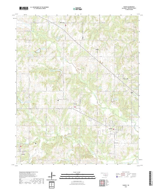
Vanoss and Pickett anchor the southern reaches of this Pontotoc County landscape, where the headwaters of Canadian Sandy Cr and its tributaries carve a network of drainages through the territory. The map documents a predominantly rural infrastructure of section-line roads such as Co RD 1540 and Co RD 1510, connecting scattered settlements including Oil Center, Bebee, and Union Hill.
Find a feature on this map
60 named features on this map. Tap any name to fly to it.
Don’t see what you’re looking for? This feature index may not catch every label — zoom into the map to look around manually.
Map Details
Date Portrayed2022
Date Published2022
PublisherU.S. Geological Survey
Map TypeTopographic
Scale1:24000
Physical Dimensions24 x 29 inches
Editions of this 2022 Vanoss Map
This is the sole edition of this map. No revisions or reprints were ever made.
Historical Maps of Bebee Through Time
Featured Locations
Source Details
SourceU.S. Geological Survey
CopyrightPublic Domain