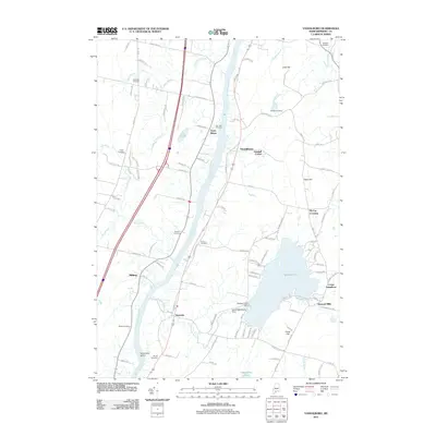
2011 Map of Vassalboro
USGS Topo · Published 2011About this map
The Kennebec River serves as the central axis for this coastal Maine landscape, dividing the settlements of Sidney and Riverside to the west from the village centers of Vassalboro and Getchell Corner to the east. The terrain is defined by a series of north-south ridges, with elevated points like Cook Hill and Taber Hill overlooking the expansive Webber Pond. The water network is intricate, featuring drainage from Sevenmile Brook and the Outlet Stream, controlled in part by the Webber Pond Dam and the Seven Mile Brook Dam.
Find a feature on this map
109 named features on this map. Tap any name to fly to it.
Don’t see what you’re looking for? This feature index may not catch every label — zoom into the map to look around manually.
Map Details
Editions of this 2011 Vassalboro Map
This is the sole edition of this map. No revisions or reprints were ever made.
Other maps of this area

1892 · Waterville
USGS Topo · 1:62,500

1892 · Augusta
USGS Topo · 1:62,500

1893 · Vassalboro
USGS Topo · 1:62,500

1894 · Norridgewock
USGS Topo · 1:62,500

1898 · Norridgewock
USGS Topo · 1:62,500

1898 · Vassalboro
USGS Topo · 1:62,500

1941 · Vassalboro
USGS Topo · 1:62,500

1941 · Augusta
USGS Topo · 1:62,500

1943 · Augusta
USGS Topo · 1:62,500

1943 · Vassalboro
USGS Topo · 1:62,500