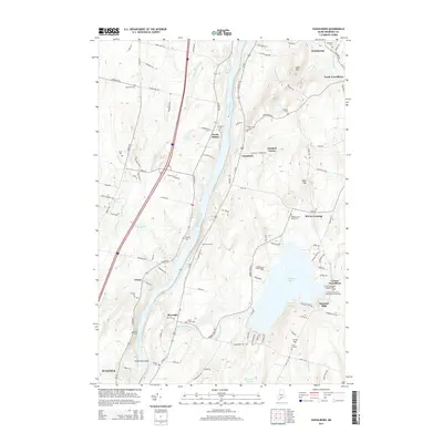
2014 Map of Vassalboro
USGS Topo · Published 2014About this map
The Kennebec River carves a central path through this portion of Kennebec County, anchoring several riverfront settlements and agricultural uplands. On the eastern bank, Vassalboro and North Vassalboro serve as primary hubs, with smaller locales like Getchell Corner and McCoy Crossing indicating a dense historical network of crossroads and small communities. The landscape is dotted with numerous burial grounds, including the Oak Grove Cem and Webber Pond Road Cem, which offer significant value for genealogical research in this region.
Find a feature on this map
114 named features on this map. Tap any name to fly to it.
Don’t see what you’re looking for? This feature index may not catch every label — zoom into the map to look around manually.
Map Details
Editions of this 2014 Vassalboro Map
This is the sole edition of this map. No revisions or reprints were ever made.
Other maps of this area

1892 · Waterville
USGS Topo · 1:62,500

1892 · Augusta
USGS Topo · 1:62,500

1893 · Vassalboro
USGS Topo · 1:62,500

1894 · Norridgewock
USGS Topo · 1:62,500

1898 · Norridgewock
USGS Topo · 1:62,500

1898 · Vassalboro
USGS Topo · 1:62,500

1941 · Vassalboro
USGS Topo · 1:62,500

1941 · Augusta
USGS Topo · 1:62,500

1943 · Augusta
USGS Topo · 1:62,500

1943 · Vassalboro
USGS Topo · 1:62,500