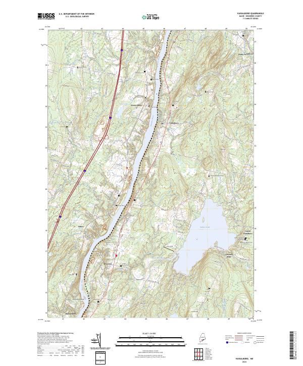
2024 Map of Vassalboro
USGS Topo · Published 2024About this map
The Kennebec River corridor defines this part of Maine, where the waterway separates the towns of Sidney and Vassalboro. This 2024 survey documents a landscape of traditional riverfront settlements and inland heights like Coyote Ridge and Cook Hill. Genealogists will find a high density of small family and community burial grounds, including the Barton Cem, Smiley Farm Cem, and Springer Cem along the river banks, as well as the Webber Pond Road Cem and Cross Hill Cem further east. The eastern side is dominated by the large expanse of Webber Pond, which is fed by Seven Mile Brook. Smaller settlements such as North Vassalboro, Riverside, and Seaward Mills are mapped in detail, showing how modern development follows historical patterns along Us HWY 201 and the river valley.
Find a feature on this map
112 named features on this map. Tap any name to fly to it.
Don’t see what you’re looking for? This feature index may not catch every label — zoom into the map to look around manually.
Map Details
Editions of this 2024 Vassalboro Map
This is the sole edition of this map. No revisions or reprints were ever made.
Other maps of this area

1892 · Waterville
USGS Topo · 1:62,500

1892 · Augusta
USGS Topo · 1:62,500

1893 · Vassalboro
USGS Topo · 1:62,500

1894 · Norridgewock
USGS Topo · 1:62,500

1898 · Norridgewock
USGS Topo · 1:62,500

1898 · Vassalboro
USGS Topo · 1:62,500

1941 · Vassalboro
USGS Topo · 1:62,500

1941 · Augusta
USGS Topo · 1:62,500

1943 · Augusta
USGS Topo · 1:62,500

1943 · Vassalboro
USGS Topo · 1:62,500