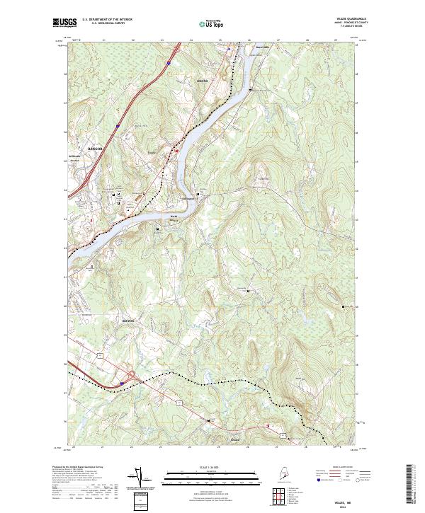
2024 Map of Veazie
USGS Topo · Published 2024About this map
The Penobscot River serves as the central artery for this contemporary landscape, dividing the riverfront communities of Orono, Veazie, and Bangor from their eastern neighbors. This recent survey captures the extensive network of cemeteries that serve the region’s diverse historical populations, including Congregation Beth Israel Cem and the Jonathan Eddy Cem. The transition from the developed urban corridors of Bangor to the outlying areas of Eddington and Holden is clearly defined, with industrial sites like Basin Mills and educational hubs like Eastern Maine Community College interspersed along the primary transit routes. In the eastern portion of the sheet, the terrain rises into Coffey Hill and Mann Hill, where the land becomes more fragmented by wetlands and water bodies such as Cummings Bog and the western edge of Chemo Pond.
Find a feature on this map
107 named features on this map. Tap any name to fly to it.
Don’t see what you’re looking for? This feature index may not catch every label — zoom into the map to look around manually.
Map Details
Editions of this 2024 Veazie Map
This is the sole edition of this map. No revisions or reprints were ever made.
Other maps of this area

1900 · Orland
USGS Topo · 1:62,500

1900 · Bucksport
USGS Topo · 1:62,500

1902 · Orono
USGS Topo · 1:62,500

1902 · Bucksport
USGS Topo · 1:62,500

1902 · Bangor
USGS Topo · 1:62,500

1942 · Orland
USGS Topo · 1:62,500

1942 · Bangor
USGS Topo · 1:62,500

1942 · Bucksport
USGS Topo · 1:62,500

1944 · Orono
USGS Topo · 1:62,500

1946 · Bangor
USGS Topo · 1:62,500