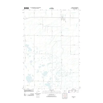
2012 Map of Veblen
USGS Topo · Published 2012About this map
Little Minnesota River and its meandering tributaries define this portion of Marshall County, South Dakota, where the prairie landscape is punctuated by numerous glacial depressions. The town center of Veblen is situated in the northeast, organized along a grid that includes S Laframbois St, Prairie Ave, and Wold Ave. Outside the town's core, the landscape transitions into a vast network of section roads and drainage features, including Shortfoot Cr and the multi-branched Laframbois Cr.
Find a feature on this map
29 named features on this map. Tap any name to fly to it.
Don’t see what you’re looking for? This feature index may not catch every label — zoom into the map to look around manually.
Map Details
Editions of this 2012 Veblen Map
This is the sole edition of this map. No revisions or reprints were ever made.
Other maps of this area

1953 · Milbank
USGS Topo · 1:250,000

1958 · Milbank
USGS Topo · 1:250,000

1958 · Hillhead
USGS Topo · 1:24,000

1958 · Veblen
USGS Topo · 1:24,000

1958 · Marlow
USGS Topo · 1:24,000

1958 · Veblen NE
USGS Topo · 1:24,000
1964 · Claire City NW
USGS Topo · 1:24,000

1964 · Claire City SW
USGS Topo · 1:24,000

1970 · Whitestone Lake
USGS Topo · 1:24,000

1970 · South Red Iron Lake
USGS Topo · 1:24,000