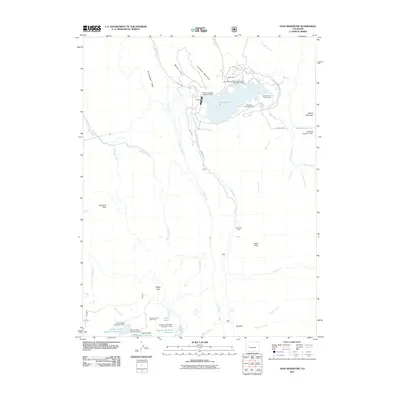
2011 Map of Vega Reservoir
USGS Topo · Published 2011About this map
Vega Reservoir serves as the central hub of this high-country landscape, bounded by Campbell Mountain and Boque Mountain. The area is characterized by a network of ranching and water management features, including the Big Creek Leon Drift Fence and numerous irrigation controls like Anderson Dam and McKelvie Number 1 Dam. Settlement is concentrated around the northern shore of the reservoir at Vega Lodge and the Aspen Grove Campground, while the southern reaches transition into more seasonal locations such as Leon Cow Camp and Sheep Flats.
Find a feature on this map
47 named features on this map. Tap any name to fly to it.
Don’t see what you’re looking for? This feature index may not catch every label — zoom into the map to look around manually.
Map Details
Editions of this 2011 Vega Reservoir Map
This is the sole edition of this map. No revisions or reprints were ever made.
Other maps of this area

1955 · Collbran
USGS Topo · 1:24,000

1955 · Grand Mesa
USGS Topo · 1:24,000

1955 · The Meadows
USGS Topo · 1:24,000

1957 · Leadville
USGS Topo · 1:250,000

1959 · Leadville
USGS Topo · 1:250,000

1960 · Leadville
USGS Topo · 1:250,000

1960 · Leon Peak
USGS Topo · 1:24,000
1960 · Hawxhurst Creek
USGS Topo · 1:24,000

1960 · South Mamm Peak
USGS Topo · 1:24,000

1961 · Porter Mountain
USGS Topo · 1:24,000