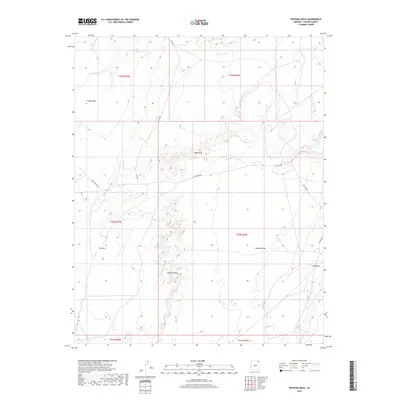
2018 Map of Ventana Mesa
USGS Topo · Published 2018About this map
Ventana Mesa and the surrounding high desert terrain dominate this corner of the Chinle Agency as it appeared in the late 2010s. The landscape is defined by massive formations such as Carson Mesa to the northwest and Red Mesa in the southeast, connected by the distinct topographic line of Red Rock Rim. Transportation across this remote part of Arizona is dictated by a network of regional and tribal routes, including BIA Rte 8090 and Indian Rte 8090, which navigate the gaps between these significant geological landmarks. Notable natural points of interest such as Hope Arch and the feature known as Tse Abe I provide specific orientation points for anyone navigating the desert floor or studying the local geography. The map reflects a modern period where traditional township and range lines, such as t32n r25e, overlay the enduring indigenous land use patterns of the region.
Find a feature on this map
17 named features on this map. Tap any name to fly to it.
Don’t see what you’re looking for? This feature index may not catch every label — zoom into the map to look around manually.
Map Details
Editions of this 2018 Ventana Mesa Map
This is the sole edition of this map. No revisions or reprints were ever made.
Other maps of this area

1892 · Canyon De Chelly
USGS Topo · 1:250,000

1954 · Shiprock
USGS Topo · 1:250,000

1955 · Chinle 4 NE
USGS Topo · 1:24,000

1955 · Chinle 4 SE
USGS Topo · 1:24,000

1958 · Shiprock
USGS Topo · 1:250,000

1959 · Shiprock
USGS Topo · 1:250,000

1968 · Many Farms SW
USGS Topo · 1:24,000
1968 · Many Farms
USGS Topo · 1:24,000
1968 · Sweathouse Peak
USGS Topo · 1:24,000
1972 · Ventana Mesa
USGS Topo · 1:24,000