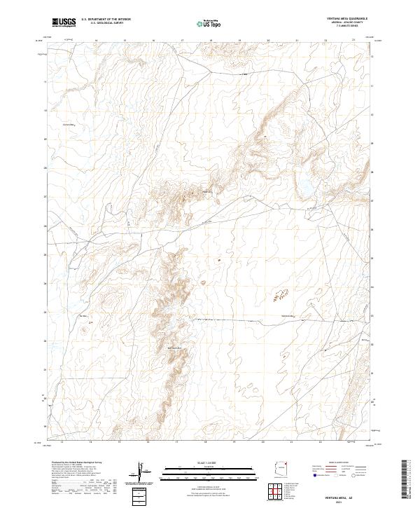
2021 Map of Ventana Mesa
USGS Topo · Published 2021About this map
The high plateau country of Apache County is defined here by the towering formation of Ventana Mesa, which anchors the central landscape. This 2021 survey illustrates a sparse but significant network of transportation routes, including BIA Rte 8090 and Indian Rte 8090, which navigate the elevation changes between the plains and the surrounding bluffs. The terrain is marked by distinctive geological features such as the Hope Arch and the sweeping curves of Red Rock Rim. In the northwest, the edge of Carson Mesa provides a stark contrast to the lower elevations, while Tse Abe I stands as a local landmark. The presence of Red Mesa in the southeast corner completes a picture of an arid, high-altitude environment where the few existing roads like Co Rd 554 must follow the natural contours of the land.
Find a feature on this map
17 named features on this map. Tap any name to fly to it.
Don’t see what you’re looking for? This feature index may not catch every label — zoom into the map to look around manually.
Map Details
Editions of this 2021 Ventana Mesa Map
This is the sole edition of this map. No revisions or reprints were ever made.
Other maps of this area

1892 · Canyon De Chelly
USGS Topo · 1:250,000

1954 · Shiprock
USGS Topo · 1:250,000

1955 · Chinle 4 NE
USGS Topo · 1:24,000

1955 · Chinle 4 SE
USGS Topo · 1:24,000

1958 · Shiprock
USGS Topo · 1:250,000

1959 · Shiprock
USGS Topo · 1:250,000

1968 · Many Farms SW
USGS Topo · 1:24,000
1968 · Many Farms
USGS Topo · 1:24,000
1968 · Sweathouse Peak
USGS Topo · 1:24,000
1972 · Ventana Mesa
USGS Topo · 1:24,000