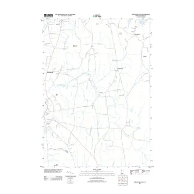
2012 Map of Vergennes East
USGS Topo · Published 2012About this map
Monkton Boro and Barnumtown anchor the agricultural landscape of Addison County, where the terrain transitions from the lowlands of Little Otter Cr toward the heights of Shellhouse Mountain and Mount Fuller. This survey documents a dense concentration of early family and community burial grounds, including the Old Quaker Cem, Abel Thompson Cem, and Borough Cem, providing a clear geography for genealogical research. The land use is defined by a mix of traditional dairy farming at locations like the Huizenga Dairy Farm and managed water resources such as the Saint Albans Reservoir. Waterways like Lewis Cr and Mud Cr cut through the central valleys, while the western edge reaches the community of Ferrisburgh, showing the enduring road networks and property divisions of this Vermont interior.
Find a feature on this map
106 named features on this map. Tap any name to fly to it.
Don’t see what you’re looking for? This feature index may not catch every label — zoom into the map to look around manually.
Map Details
Editions of this 2012 Vergennes East Map
This is the sole edition of this map. No revisions or reprints were ever made.
Other maps of this area

1894 · Port Henry
USGS Topo · 1:62,500

1895 · Willsboro
USGS Topo · 1:62,500

1898 · Port Henry
USGS Topo · 1:62,500

1903 · Middlebury
USGS Topo · 1:62,500

1905 · Middlebury
USGS Topo · 1:62,500

1906 · Burlington
USGS Topo · 1:62,500

1919 · Burlington
USGS Topo · 1:62,500

1920 · Middlebury
USGS Topo · 1:62,500

1941 · Willsboro
USGS Topo · 1:62,500

1943 · Willsboro
USGS Topo · 1:62,500