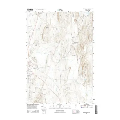
2015 Map of Vergennes East
USGS Topo · Published 2015About this map
Monkton Boro and Barnumtown anchor the eastern landscape of this Addison County region, where the terrain is defined by prominent elevations such as Shellhouse Mtn, Mt Fuller, and the long ridge of Hogback. The area is notably dense with burial grounds, providing a significant resource for genealogical research with sites including Quaker Cem, Old Quaker Cem, and the Abel Thompson Cem. These cemeteries, often named for early local families, are situated along a network of historic thoroughfares like Plank Rd and Monkton Rd. The drainage patterns of Little Otter Creek and Lewis Creek illustrate the natural irrigation of the valley floor between the city of Vergennes and the rolling hills to the east. This 2015 survey reflects a landscape that has preserved its rural character and agrarian boundaries even as modern infrastructure links these historic settlements.
Find a feature on this map
100 named features on this map. Tap any name to fly to it.
Don’t see what you’re looking for? This feature index may not catch every label — zoom into the map to look around manually.
Map Details
Editions of this 2015 Vergennes East Map
This is the sole edition of this map. No revisions or reprints were ever made.
Other maps of this area

1894 · Port Henry
USGS Topo · 1:62,500

1895 · Willsboro
USGS Topo · 1:62,500

1898 · Port Henry
USGS Topo · 1:62,500

1903 · Middlebury
USGS Topo · 1:62,500

1905 · Middlebury
USGS Topo · 1:62,500

1906 · Burlington
USGS Topo · 1:62,500

1919 · Burlington
USGS Topo · 1:62,500

1920 · Middlebury
USGS Topo · 1:62,500

1941 · Willsboro
USGS Topo · 1:62,500

1943 · Willsboro
USGS Topo · 1:62,500