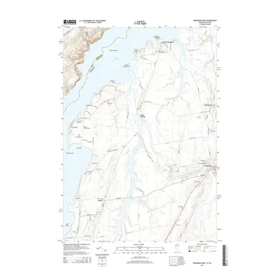
2015 Map of Vergennes West
USGS Topo · Published 2015About this map
Otter Creek snakes through the Vermont countryside, defining the local geography as it flows past Rock Landing and Vergennes toward Lake Champlain. The landscape is marked by numerous family and community burial sites, including Kellogg-Field Cem, East Panton Cem, and Basin Harbor-Beach Cem, which offer significant value for genealogical research in Panton and Ferrisburgh. These sites are interspersed among a network of rural routes such as Little Chicago Rd and Jersey St.
Find a feature on this map
98 named features on this map. Tap any name to fly to it.
Don’t see what you’re looking for? This feature index may not catch every label — zoom into the map to look around manually.
Map Details
Editions of this 2015 Vergennes West Map
This is the sole edition of this map. No revisions or reprints were ever made.
Other maps of this area

1894 · Port Henry
USGS Topo · 1:62,500

1895 · Willsboro
USGS Topo · 1:62,500

1898 · Port Henry
USGS Topo · 1:62,500

1903 · Middlebury
USGS Topo · 1:62,500

1905 · Middlebury
USGS Topo · 1:62,500

1906 · Burlington
USGS Topo · 1:62,500

1919 · Burlington
USGS Topo · 1:62,500

1920 · Middlebury
USGS Topo · 1:62,500

1941 · Willsboro
USGS Topo · 1:62,500

1943 · Willsboro
USGS Topo · 1:62,500