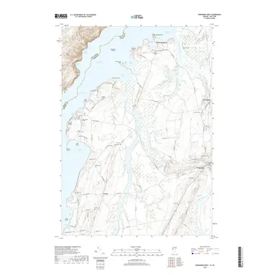
2018 Map of Vergennes West
USGS Topo · Published 2018About this map
Lake Champlain dominates the western edge of this landscape, where the state boundary between New York and Vermont cuts through The Narrows. Along the shore, a complex network of bays and points such as Kingsland Bay and Fort Cassin Point provide a view into the coastal geography of Ferrisburgh and Panton. The inland terrain is defined by the winding courses of Otter Creek and Dead Creek, which snake through low-lying lands punctuated by numerous small family and community burial grounds.
Find a feature on this map
104 named features on this map. Tap any name to fly to it.
Don’t see what you’re looking for? This feature index may not catch every label — zoom into the map to look around manually.
Map Details
Editions of this 2018 Vergennes West Map
This is the sole edition of this map. No revisions or reprints were ever made.
Other maps of this area

1894 · Port Henry
USGS Topo · 1:62,500

1895 · Willsboro
USGS Topo · 1:62,500

1898 · Port Henry
USGS Topo · 1:62,500

1903 · Middlebury
USGS Topo · 1:62,500

1905 · Middlebury
USGS Topo · 1:62,500

1906 · Burlington
USGS Topo · 1:62,500

1919 · Burlington
USGS Topo · 1:62,500

1920 · Middlebury
USGS Topo · 1:62,500

1941 · Willsboro
USGS Topo · 1:62,500

1943 · Willsboro
USGS Topo · 1:62,500