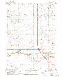
1969 Map of Vermillion SE
USGS Topo · Published 1971About this map
Junction City and the surrounding plains of the Clay Co Union Co border are captured in this 1969 field survey. The landscape is defined by its agrarian infrastructure, specifically the network of rural schools and churches such as Walnut Grove Sch and St Marys Ch. The topography shifts between the high Prairie Center and Fairview uplands down toward the marshy lowlands of Big Brule Slough and Government Slough.
Find a feature on this map
24 named features on this map. Tap any name to fly to it.
Don’t see what you’re looking for? This feature index may not catch every label — zoom into the map to look around manually.
Map Details
Editions of this 1969 Vermillion SE Map
This is the sole edition of this map. No revisions or reprints were ever made.
Other maps of this area

1898 · Elk Point
USGS Topo · 1:125,000

1901 · Elk Point
USGS Topo · 1:125,000

1907 · Elk Point
USGS Topo · 1:125,000

1955 · Sioux City
USGS Topo · 1:250,000

1958 · Sioux City
USGS Topo · 1:250,000

1959 · Sioux City
USGS Topo · 1:250,000

1963 · Elk Point
USGS Topo · 1:24,000

1964 · Burbank
USGS Topo · 1:24,000

1964 · Maskell
USGS Topo · 1:24,000
1969 · Hub City
USGS Topo · 1:24,000