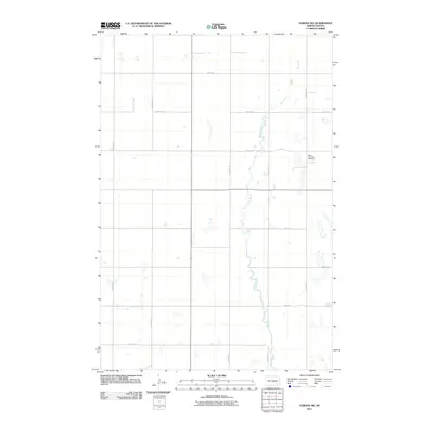
2011 Map of Verona NE
USGS Topo · Published 2011About this map
Bear Creek meanders through the heart of this Ransom County landscape, defining the local hydrology and the placement of rural infrastructure during this 2011 survey. The terrain is structured by a rigorous grid of section lines and gravel roads, including north-south corridors like 114th Ave SE and east-west routes such as 65th St SE and 71st St SE. This agricultural area in Fort Ransom Township maintains its traditional rural character, where the vast majority of the land is dedicated to open fields and small water bodies. A significant point of local history is the West Fairview Cemetery, located in the northeastern portion of the quadrangle. This site serves as a vital anchor for genealogists and local historians researching the families who settled this portion of the North Dakota plains, illustrating the enduring footprint of early pioneer communities.
Find a feature on this map
14 named features on this map. Tap any name to fly to it.
Don’t see what you’re looking for? This feature index may not catch every label — zoom into the map to look around manually.
Map Details
Editions of this 2011 Verona NE Map
This is the sole edition of this map. No revisions or reprints were ever made.
Other maps of this area

1895 · Lamoure
USGS Topo · 1:125,000

1897 · Tower
USGS Topo · 1:125,000

1897 · Eckelson
USGS Topo · 1:125,000

1918 · La Moure
USGS Topo · 1:125,000

1952 · Independence
USGS Topo · 1:24,000

1953 · Jamestown
USGS Topo · 1:250,000

1953 · Fargo
USGS Topo · 1:250,000

1956 · Fargo
USGS Topo · 1:250,000

1956 · Jamestown
USGS Topo · 1:250,000

1957 · Elliott SW
USGS Topo · 1:24,000
Featured Places
- Fort Ransom Township, ND
- Black Loam Township, ND
- Greenville Township, ND
- Hanson Township, ND
- LaMoure County, ND