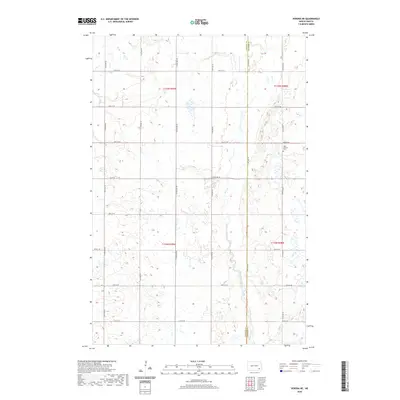
2020 Map of Verona NE
USGS Topo · Published 2020About this map
The county line between LaMoure Co and Ransom Co divides this rural North Dakota landscape, where the meandering course of Bear Creek flows through the eastern sections. This survey preserves the exact placement of local landmarks like the West Fairview Cem, which sits isolated along 115th Ave SE. The terrain is defined by a grid of agricultural section roads including Co Rd 34 and 67th St SE, which navigate a pockmarked landscape of prairie potholes and small wetlands. The map provides a precise layout of the t135n r58w and surrounding townships, showing the intersection of traditional land survey boundaries with the natural drainage patterns of the eastern plains.
Find a feature on this map
23 named features on this map. Tap any name to fly to it.
Don’t see what you’re looking for? This feature index may not catch every label — zoom into the map to look around manually.
Map Details
Editions of this 2020 Verona NE Map
This is the sole edition of this map. No revisions or reprints were ever made.
Other maps of this area

1895 · Lamoure
USGS Topo · 1:125,000

1897 · Tower
USGS Topo · 1:125,000

1897 · Eckelson
USGS Topo · 1:125,000

1918 · La Moure
USGS Topo · 1:125,000

1952 · Independence
USGS Topo · 1:24,000

1953 · Jamestown
USGS Topo · 1:250,000

1953 · Fargo
USGS Topo · 1:250,000

1956 · Fargo
USGS Topo · 1:250,000

1956 · Jamestown
USGS Topo · 1:250,000

1957 · Elliott SW
USGS Topo · 1:24,000
Featured Places
- Fort Ransom Township, ND
- Black Loam Township, ND
- Greenville Township, ND
- Hanson Township, ND
- LaMoure County, ND