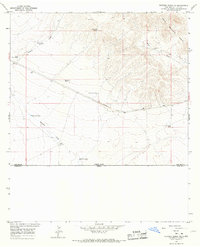
1964 Map of Victorio Ranch SE
USGS Topo · Published 1967About this map
The United States-Mexico border defines the southern edge of this mid-1960s survey, where the arid high desert of New Mexico meets Chihuahua. The landscape is dominated by the southern reaches of the Cedar Mountain Range and a network of ephemeral watercourses including Wamels Draw and Baker Draw. These drainage patterns dictated the placement of critical ranching infrastructure, evidenced by numerous water features such as Wamels Lower Well, Upper Well, and several numbered tanks like Tank No 5 North.
Find a feature on this map
17 named features on this map. Tap any name to fly to it.
Don’t see what you’re looking for? This feature index may not catch every label — zoom into the map to look around manually.
Map Details
Editions of this 1964 Victorio Ranch SE Map
This is the sole edition of this map. No revisions or reprints were ever made.
Other maps of this area

1917 · Hermanas
USGS Topo · 1:62,500

1918 · Hermanas
USGS Topo · 1:62,500

1918 · Victorio
USGS Topo · 1:62,500

1943 · Hermanas
USGS Topo · 1:62,500

1953 · El Paso
USGS Topo · 1:250,000

1955 · Douglas
USGS Topo · 1:250,000

1959 · Douglas
USGS Topo · 1:250,000

1959 · El Paso
USGS Topo · 1:250,000

1961 · Douglas
USGS Topo · 1:250,000

1964 · El Paso
USGS Topo · 1:250,000