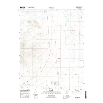
2016 Map of Villa Grove
USGS Topo · Published 2016About this map
Villa Grove and the namesake waters of Mineral Hot Springs anchor this portion of the northern San Luis Valley during the mid-2010s. The landscape is defined by the transition from the high-desert valley floor to the foothills of the San Juan Mountains, marked by the prominent height of Clayton Cone. Water management for agriculture is a central feature of the local geography, evidenced by the extensive network of irrigation infrastructure including the Schultze Dettrick Ditch and the San Luis Company Ditch which parallel the natural course of San Luis Cr. This map reveals a grid of rural residential development south of the springs, with neighborhood streets like Nakashima Ave, Barela Dr, and Martinez Dr indicating more modern settlement patterns amidst traditional ranching country. Drainages such as Noland Gulch and Big Hollow Gulch underscore the seasonal water movement through this arid environment.
Find a feature on this map
51 named features on this map. Tap any name to fly to it.
Don’t see what you’re looking for? This feature index may not catch every label — zoom into the map to look around manually.
Map Details
Editions of this 2016 Villa Grove Map
This is the sole edition of this map. No revisions or reprints were ever made.
Other maps of this area
1950 · Valley View Hot Springs
USGS Topo · 1:24,000
1954 · Pueblo
USGS Topo · 1:250,000
1956 · Montrose
USGS Topo · 1:250,000
1957 · Pueblo
USGS Topo · 1:250,000
1958 · Pueblo
USGS Topo · 1:250,000
1959 · Montrose
USGS Topo · 1:250,000
1959 · Bonanza
USGS Topo · 1:62,500
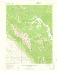
1959 · Howard
USGS Topo · 1:62,500
1960 · Montrose
USGS Topo · 1:250,000
1962 · Pueblo
USGS Topo · 1:250,000