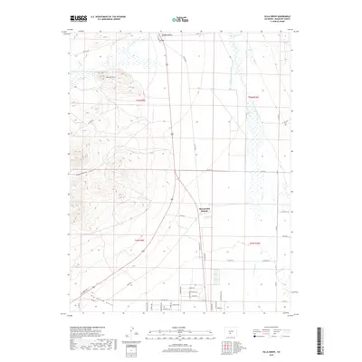
2019 Map of Villa Grove
USGS Topo · Published 2019About this map
Villa Grove sits at the northern edge of this high-altitude landscape where the valley floor meets the rising terrain of the northern San Luis Valley. This 2019 survey highlights a complex water management system essential to the region's agricultural history, featuring the Schultze-Pettisick Ditch and the San Luis Valley Canal Ditch. These man-made waterways divert flows from San Luis Cr and Kerber Cr to sustain the arid plains below the peaks. To the south, the settlement of Mineral Hot Springs marks a localized geothermal feature near the intersection of several county roads. The western portion of the map is defined by prominent topographical landmarks like Clayton Cone and the deep incisions of Noland Gulch and Big Hollow Gulch. The road network, including Red Cloud Ave and Clayton Rd, connects these scattered homesteads and natural resources across a landscape shaped by both water rights and volcanic geology.
Find a feature on this map
52 named features on this map. Tap any name to fly to it.
Don’t see what you’re looking for? This feature index may not catch every label — zoom into the map to look around manually.
Map Details
Editions of this 2019 Villa Grove Map
This is the sole edition of this map. No revisions or reprints were ever made.
Other maps of this area

1950 · Valley View Hot Springs
USGS Topo · 1:24,000

1954 · Pueblo
USGS Topo · 1:250,000

1956 · Montrose
USGS Topo · 1:250,000

1957 · Pueblo
USGS Topo · 1:250,000

1958 · Pueblo
USGS Topo · 1:250,000

1959 · Montrose
USGS Topo · 1:250,000

1959 · Bonanza
USGS Topo · 1:62,500

1959 · Howard
USGS Topo · 1:62,500

1960 · Montrose
USGS Topo · 1:250,000

1962 · Pueblo
USGS Topo · 1:250,000