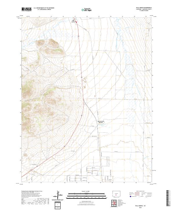
2022 Map of Villa Grove
USGS Topo · Published 2022About this map
Villa Grove and the thermal waters of Mineral Hot Springs anchor this portion of the northern San Luis Valley. The landscape transitions from the sharp relief of Clayton Cone and Clayton Gulch in the west to the expansive drainage basin of San Luis Cr in the east. This area is defined by its complex irrigation network, critical for high-altitude agriculture, including the San Luis Company Ditch and Schultze Detrick Ditch. Numerous seasonal and perennial watercourses like Kerber Cr and Garner Cr flow from the surrounding highlands into the valley floor. The map also records a dense concentration of local roads and named residential streets such as Red Cloud Ave and Blackburn Dr south of the springs, reflecting contemporary land use and modern settlement patterns within Saguache County.
Find a feature on this map
54 named features on this map. Tap any name to fly to it.
Don’t see what you’re looking for? This feature index may not catch every label — zoom into the map to look around manually.
Map Details
Editions of this 2022 Villa Grove Map
This is the sole edition of this map. No revisions or reprints were ever made.
Other maps of this area

1950 · Valley View Hot Springs
USGS Topo · 1:24,000

1954 · Pueblo
USGS Topo · 1:250,000

1956 · Montrose
USGS Topo · 1:250,000

1957 · Pueblo
USGS Topo · 1:250,000

1958 · Pueblo
USGS Topo · 1:250,000

1959 · Montrose
USGS Topo · 1:250,000

1959 · Bonanza
USGS Topo · 1:62,500

1959 · Howard
USGS Topo · 1:62,500

1960 · Montrose
USGS Topo · 1:250,000

1962 · Pueblo
USGS Topo · 1:250,000