2022 Map of Vining
USGS Topo · Published 2022About this map
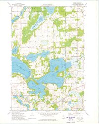
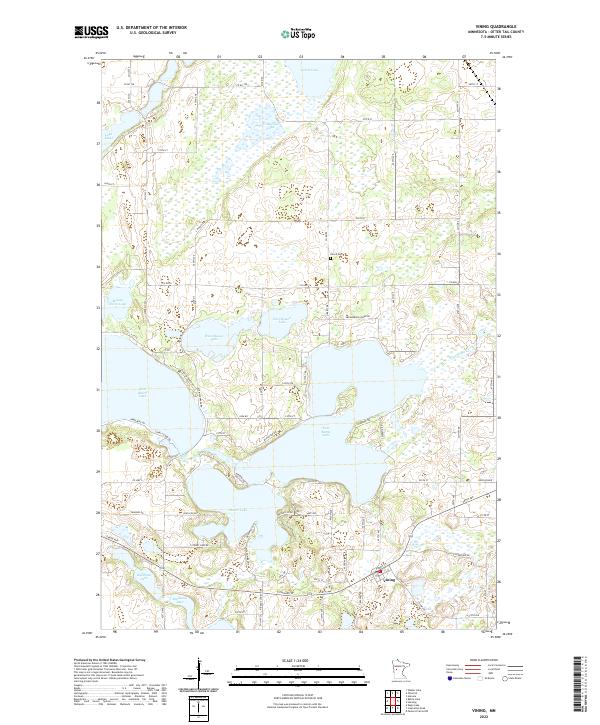
The village of Vining serves as the focal point of this Otter Tail County survey, situated at the junction of modern local roads near the southern edge of the map. The landscape is defined by its dense concentration of glacial basins, ranging from the expansive waters of West Battle Lake and East Battle Lake to the smaller, secluded shores of Bullhead Lake and Bredeson Lake. A notable historical landmark is Girard Cem, located north of the village and east of the West Mason Lake and East Mason Lake pairing. The drainage pattern is quietly traced by the path of Brandborg Cr, which connects several water bodies in the east. This layout reveals a rural community where settlement follows the contours of the lakeshore and the section lines of the Public Land Survey System, with numerous local routes like Chippewa Trl and Clarissa Haven Dr providing access to residential pockets along the larger shorelines.
Find a feature on this map
89 named features on this map. Tap any name to fly to it.
Don’t see what you’re looking for? This feature index may not catch every label — zoom into the map to look around manually.
Map Details
Editions of this 2022 Vining Map
This is the sole edition of this map. No revisions or reprints were ever made.