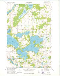
1973 Map of Vining
USGS Topo · Published 1975About this map
Vining sits at the southern edge of this lake-dotted landscape in Otter Tail County, a community defined by its proximity to the Burlington Northern railroad and the surrounding agricultural tracts. The map reveals a complex glacial topography where large water bodies like West Battle Lake and East Battle Lake dominate the terrain. Smaller, family-named features like Bredeson Lake and Lake Ethel are scattered throughout, interspersed with various Gravel Pits and a local Townhall in Girard township. The rural character of the early 1970s is evident in the dense network of field lines and fences that partition the land between the lakes. Genealogists may find interest in the Girard Cem or the small cluster of buildings at Stuart near the shores of Stuart Lake.
Find a feature on this map
32 named features on this map. Tap any name to fly to it.
Don’t see what you’re looking for? This feature index may not catch every label — zoom into the map to look around manually.
Map Details
Editions of this 1973 Vining Map
This is the sole edition of this map. No revisions or reprints were ever made.
Other maps of this area

1912 · Battle Lake
USGS Topo · 1:62,500

1914 · Battle Lake
USGS Topo · 1:62,500

1953 · Brainerd
USGS Topo · 1:250,000

1957 · Brainerd
USGS Topo · 1:250,000

1958 · Brainerd
USGS Topo · 1:250,000

1965 · Brainerd
USGS Topo · 1:250,000

1969 · Henning
USGS Topo · 1:24,000

1969 · Eagle Lake
USGS Topo · 1:24,000
1969 · Parkers Prairie NW
USGS Topo · 1:24,000

1969 · Heinola
USGS Topo · 1:24,000