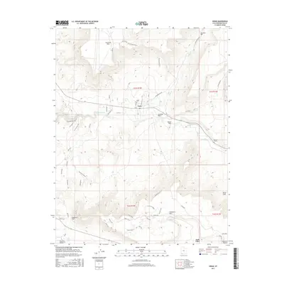
2017 Map of Virgin
USGS Topo · Published 2017About this map
The Virgin River carves through this southwestern Utah corridor, anchoring a landscape where the small settlement of Virgin sits amidst dramatic topographical shifts. The map illustrates a high-desert environment defined by massive plateaus and deep drainage systems, including Cornelius Wash and Dalton Wash. High above the river valley, the flat-topped expanses of Hurricane Mesa and Gooseberry Mesa dominate the horizon. This 2017 survey reflects the area's modern identity as a hub for outdoor recreation, featuring an extensive network of named paths such as the Hurricane Rim Trail, JEM Trail, and Flying Monkey Trail. For those looking further back, the map identifies the Virgin Cem and the location of Duncan's Retreat, providing valuable markers for local genealogy and historical geography. The road network, including Kolob Reservoir Rd and Saint Dirt Rd, shows how accessibility has evolved around these traditional river settlements.
Find a feature on this map
42 named features on this map. Tap any name to fly to it.
Don’t see what you’re looking for? This feature index may not catch every label — zoom into the map to look around manually.
Map Details
Editions of this 2017 Virgin Map
This is the sole edition of this map. No revisions or reprints were ever made.
Other maps of this area

1885 · St. George
USGS Topo · 1:250,000

1891 · St. George
USGS Topo · 1:250,000

1953 · Cedar City
USGS Topo · 1:250,000

1954 · La Verkin 4 SE
USGS Topo · 1:24,000

1954 · La Verkin 4 NW
USGS Topo · 1:24,000

1954 · La Verkin 4 SW
USGS Topo · 1:24,000

1954 · La Verkin 3 NE
USGS Topo · 1:24,000

1954 · La Verkin 1 SW
USGS Topo · 1:24,000

1954 · La Verkin 3 SE
USGS Topo · 1:24,000

1954 · La Verkin 2 SE
USGS Topo · 1:24,000