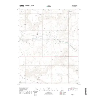
2020 Map of Virgin
USGS Topo · Published 2020About this map
Virgin sits at a low point in the dramatic topography of Washington County, where the Virgin River cuts a path between massive flat-topped landforms. To the north, Smith Mesa and Hurricane Mesa tower over the valley, while Gooseberry Mesa and the Uinkaret Plateau dominate the southern half of the sheet. The settlement pattern follows the water and the few viable routes through the high desert, with the Virgin Cem and Duncan's Retreat Cem marking the generational presence of local families. This landscape is a convergence of natural drainage and modern recreation, evidenced by the intricate networks of the Hurricane Rim Trail and the White Trail winding across the plateaus. To the southeast, the development of Apple Valley contrasts with the steep, inaccessible walls of Pastry Ridge, illustrating how modern infrastructure utilizes the narrow corridors of relatively level ground between the region's formidable geological barriers.
Find a feature on this map
41 named features on this map. Tap any name to fly to it.
Don’t see what you’re looking for? This feature index may not catch every label — zoom into the map to look around manually.
Map Details
Editions of this 2020 Virgin Map
This is the sole edition of this map. No revisions or reprints were ever made.
Other maps of this area

1885 · St. George
USGS Topo · 1:250,000

1891 · St. George
USGS Topo · 1:250,000

1953 · Cedar City
USGS Topo · 1:250,000

1954 · La Verkin 4 SE
USGS Topo · 1:24,000

1954 · La Verkin 4 NW
USGS Topo · 1:24,000

1954 · La Verkin 4 SW
USGS Topo · 1:24,000

1954 · La Verkin 3 NE
USGS Topo · 1:24,000

1954 · La Verkin 1 SW
USGS Topo · 1:24,000

1954 · La Verkin 3 SE
USGS Topo · 1:24,000

1954 · La Verkin 2 SE
USGS Topo · 1:24,000