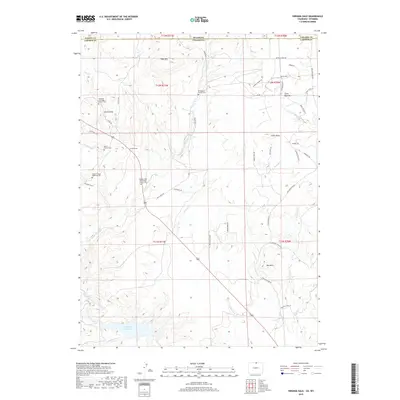
2019 Map of Virginia Dale
USGS Topo · Published 2019About this map
The Virginia Dale settlement sits at the heart of this high-country landscape along the border of Colorado and Wyoming. Notable for its deep genealogical value, the area contains several distinct burial sites including the Overland Trail Stage Station Cem, the Murchland Family Cem, and the Boyd Family Cem. These sites, along with the Virginia Dale Community Church Cem, indicate a legacy of early family ranching and travel along the historic corridor. The terrain is defined by prominent elevations such as Table Mtn and Lovers Leap, while the southern reaches are shaped by the Halligan Reservoir and the N Fork Cache La Poudre River. Numerous drainage systems like Deadman Cr and Tenmile Cr carve through the foothills, illustrating the complex hydrology that supported these high-altitude communities.
Find a feature on this map
54 named features on this map. Tap any name to fly to it.
Don’t see what you’re looking for? This feature index may not catch every label — zoom into the map to look around manually.
Map Details
Editions of this 2019 Virginia Dale Map
This is the sole edition of this map. No revisions or reprints were ever made.
Other maps of this area

1905 · Sherman
USGS Topo · 1:125,000

1907 · Livermore
USGS Topo · 1:125,000

1909 · Livermore
USGS Topo · 1:125,000

1948 · Sherman Mountains
USGS Topo · 1:62,500

1950 · Sherman Mountains
USGS Topo · 1:62,500

1954 · Cheyenne
USGS Topo · 1:250,000

1954 · Greeley
USGS Topo · 1:250,000

1957 · Greeley
USGS Topo · 1:250,000

1958 · Cheyenne
USGS Topo · 1:250,000

1958 · Greeley
USGS Topo · 1:250,000