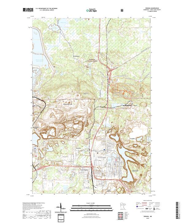
2022 Map of Virginia
USGS Topo · Published 2022About this map
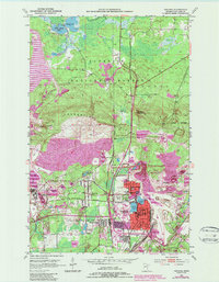
The Mesabi Range defines the industrial and geographic character of this Iron Range corridor, where the Laurentian Divide separates the watersheds of the northern wilderness from the developed mining and residential centers. The city of Virginia serves as a primary hub, centered around Virginia Lake and Silver Lake, and housing the Saint Louis County Courthouse. To the west, the community of Mountain Iron sits at the edge of the massive Minntac Tailings Basin Cell One, a striking visual reminder of the area's deep ties to taconite production.
Find a feature on this map
60 named features on this map. Tap any name to fly to it.
Don’t see what you’re looking for? This feature index may not catch every label — zoom into the map to look around manually.
Map Details
Editions of this 2022 Virginia Map
This is the sole edition of this map. No revisions or reprints were ever made.