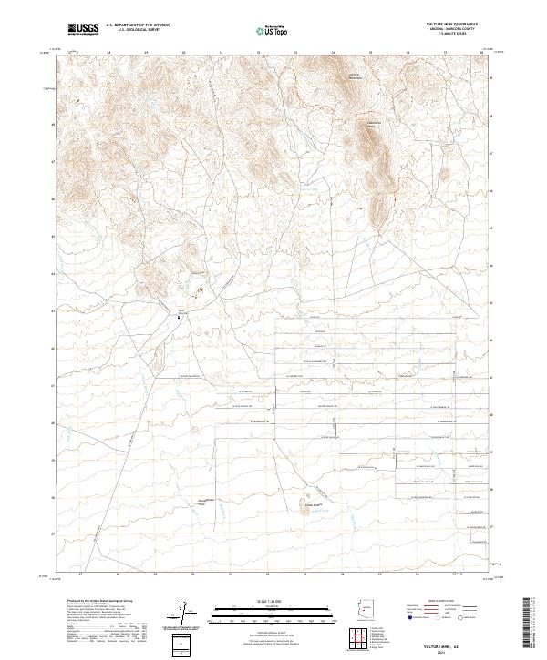
2021 Map of Vulture Mine
USGS Topo · Published 2021About this map
The Vulture Mine serves as the focal point of this arid landscape, situated at the edge of the Vulture Mountains and overlooking the wide expanse of the Hassayampa Plain. This modern survey illustrates the enduring footprint of mining operations alongside the desert's natural drainage patterns, including Mill Wash and Jimmie Wash. The area retains significant cultural markers such as the Verde Flats Cem, providing a direct link to the community that once supported the mine's operations. The terrain to the north is defined by prominent elevations like Caballeros Peaks and the volcanic forms of Indian Buttes. Water management is represented by essential features like Garcia Tank and Indian Tank, while the growing grid of the valley to the south is visible through thoroughfares such as W Carefree Hwy and W Lone Mountain Rd.
Find a feature on this map
43 named features on this map. Tap any name to fly to it.
Don’t see what you’re looking for? This feature index may not catch every label — zoom into the map to look around manually.
Map Details
Editions of this 2021 Vulture Mine Map
This is the sole edition of this map. No revisions or reprints were ever made.
Other maps of this area

1954 · Phoenix
USGS Topo · 1:250,000

1957 · Phoenix
USGS Topo · 1:250,000

1957 · White Tank Mts.
USGS Topo · 1:62,500

1958 · Phoenix
USGS Topo · 1:250,000

1960 · Phoenix
USGS Topo · 1:250,000

1961 · Vulture Mountains
USGS Topo · 1:62,500

1962 · Belmont Mts
USGS Topo · 1:62,500
1964 · Wickenburg
USGS Topo · 1:24,000
1965 · Wickenburg SW
USGS Topo · 1:24,000

1969 · Phoenix
USGS Topo · 1:250,000