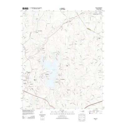
2013 Map of Waco
USGS Topo · Published 2013About this map
Kings Mountain Reservoir dominates the central landscape of this 2013 survey, its irregular shoreline reaching into the surrounding residential and rural communities of Cleveland and Gaston counties. To the west, the suburban expansion of Shelby is evident in neighborhoods like Elizabeth City and Light Oak, where the Cleveland County Fairgrounds and Cleveland Community Coll serve as regional hubs. The transition from these developed areas into the more rural northern reaches is marked by small settlements such as Waco and New Prospect. Local heritage is anchored by several burial grounds, including the Capernaum Cem and Hullender Cem, which provide specific points of reference for genealogists. The terrain is defined by the drainage systems of Buffalo Creek and the Muddy Fork, which feed the reservoir and dictate the winding path of the local road network through these Piedmont communities.
Find a feature on this map
205 named features on this map. Tap any name to fly to it.
Don’t see what you’re looking for? This feature index may not catch every label — zoom into the map to look around manually.
Map Details
Editions of this 2013 Waco Map
This is the sole edition of this map. No revisions or reprints were ever made.
Other maps of this area

1906 · Kings Mountain
USGS Topo · 1:62,500

1908 · Kings Mountain
USGS Topo · 1:62,500

1909 · Gaffney
USGS Topo · 1:62,500

1909 · Lincolnton
USGS Topo · 1:62,500

1911 · Lincolnton
USGS Topo · 1:62,500

1950 · Shelby
USGS Topo · 1:62,500

1953 · Charlotte
USGS Topo · 1:250,000

1954 · Charlotte
USGS Topo · 1:250,000

1960 · Charlotte
USGS Topo · 1:250,000

1962 · Charlotte
USGS Topo · 1:250,000