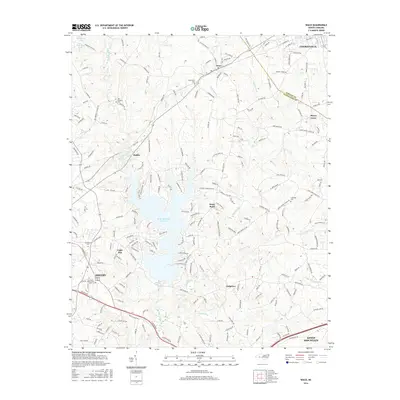
2016 Map of Waco
USGS Topo · Published 2016About this map
Kings Mountain Reservoir, also known locally as Moss Lake, dominates the central landscape of this Cleveland County region. The reservoir is fed by Buffalo Creek and Suck Cr, creating a complex shoreline that defines the residential patterns of communities like Stony Point and Light Oak. This survey provides a clear view of the rural-to-suburban transition between the larger centers of Shelby to the southwest and Cherryville in the northeast corner.
Find a feature on this map
208 named features on this map. Tap any name to fly to it.
Don’t see what you’re looking for? This feature index may not catch every label — zoom into the map to look around manually.
Map Details
Editions of this 2016 Waco Map
This is the sole edition of this map. No revisions or reprints were ever made.
Other maps of this area

1906 · Kings Mountain
USGS Topo · 1:62,500

1908 · Kings Mountain
USGS Topo · 1:62,500

1909 · Gaffney
USGS Topo · 1:62,500

1909 · Lincolnton
USGS Topo · 1:62,500

1911 · Lincolnton
USGS Topo · 1:62,500

1950 · Shelby
USGS Topo · 1:62,500

1953 · Charlotte
USGS Topo · 1:250,000

1954 · Charlotte
USGS Topo · 1:250,000

1960 · Charlotte
USGS Topo · 1:250,000

1962 · Charlotte
USGS Topo · 1:250,000