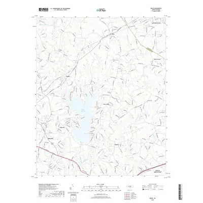
2019 Map of Waco
USGS Topo · Published 2019About this map
Kings Mountain Reservoir dominates the central landscape of this Cleveland County region, its branching fingers reaching into the surrounding terrain where the waters of Buffalo Creek are impounded. The area is characterized by a network of established communities and rural crossroads, with the town of Waco situated north of the reservoir and the edges of larger settlements like Shelby, Cherryville, and Kings Mountain appearing at the quadrangle margins. For genealogists, the map preserves the locations of several burial grounds including New Prospect Cem and Capernaum Cem. The transition from the more developed street grids of Light Oak and Marys Grove to the wooded drainages of Muddy Fork and Persimmon Cr illustrates the mid-20th-century growth patterns of the North Carolina Piedmont, where residential pockets expanded alongside traditional agricultural lands and creek-bottom timber.
Find a feature on this map
217 named features on this map. Tap any name to fly to it.
Don’t see what you’re looking for? This feature index may not catch every label — zoom into the map to look around manually.
Map Details
Editions of this 2019 Waco Map
This is the sole edition of this map. No revisions or reprints were ever made.
Other maps of this area

1906 · Kings Mountain
USGS Topo · 1:62,500

1908 · Kings Mountain
USGS Topo · 1:62,500

1909 · Gaffney
USGS Topo · 1:62,500

1909 · Lincolnton
USGS Topo · 1:62,500

1911 · Lincolnton
USGS Topo · 1:62,500

1950 · Shelby
USGS Topo · 1:62,500

1953 · Charlotte
USGS Topo · 1:250,000

1954 · Charlotte
USGS Topo · 1:250,000

1960 · Charlotte
USGS Topo · 1:250,000

1962 · Charlotte
USGS Topo · 1:250,000