2022 Map of Waco
USGS Topo · Published 2022About this map
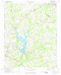
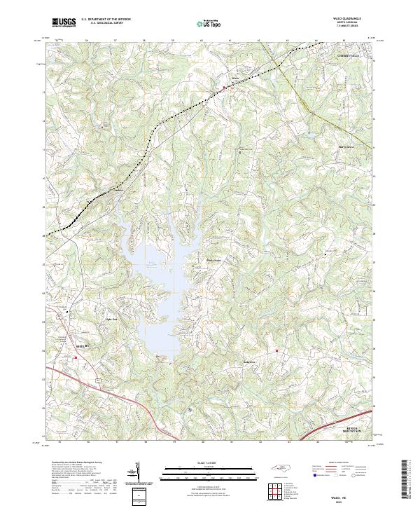
The Kings Mountain Reservoir dominates the central landscape of this western North Carolina survey, its irregular fingers reaching into the surrounding Piedmont terrain. The area is defined by a dense network of residential and rural routes, connecting established settlements like Waco and Marys Grove with numerous smaller communities including Light Oak and Oakgrove. The map provides significant detail for local historians, documenting scattered family and community burial sites such as New Prospect Cem and Capernaum Cem.
Find a feature on this map
219 named features on this map. Tap any name to fly to it.
Don’t see what you’re looking for? This feature index may not catch every label — zoom into the map to look around manually.
Map Details
Editions of this 2022 Waco Map
This is the sole edition of this map. No revisions or reprints were ever made.