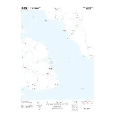
2013 Map of Wade Point
USGS Topo · Published 2013About this map
Pasquotank River dominates this coastal landscape where the river mouth opens into the Atlantic Ocean. The area is defined by numerous points and necks of land that stretch into the water, creating a complex shoreline of coves and bays. Small residential enclaves like Glen Cove and Goose Creek are connected by a network of rural roads such as Wadespoint Rd and Frog Island Rd. The map illustrates a transitional landscape between the river and the sea, where land names like Frog Island and Sound Neck suggest a history deeply tied to the water. To the east, the settlement of Texas sits near Poquoson Point, while Old Trap serves as a northern inland hub. The lack of heavy industry or large urban centers highlights the area's enduring character as a collection of coastal hamlets and points of interest like Wade Point and Wades Bluff.
Find a feature on this map
53 named features on this map. Tap any name to fly to it.
Don’t see what you’re looking for? This feature index may not catch every label — zoom into the map to look around manually.
Map Details
Editions of this 2013 Wade Point Map
This is the sole edition of this map. No revisions or reprints were ever made.
Other maps of this area

1940 · Barco
USGS Topo · 1:62,500

1940 · Powells Point
USGS Topo · 1:62,500

1940 · Wade Point
USGS Topo · 1:62,500

1943 · Wade Point
USGS Topo · 1:62,500

1946 · Eastville
USGS Topo · 1:250,000

1946 · Currituck Sound
USGS Topo · 1:250,000

1948 · Wade Point
USGS Topo · 1:62,500

1948 · Elizabeth City
USGS Topo · 1:62,500

1953 · Norfolk
USGS Topo · 1:250,000

1961 · Eastville
USGS Topo · 1:250,000