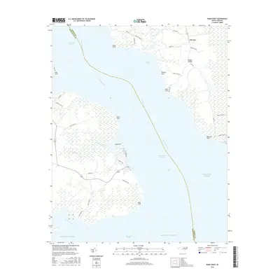
2016 Map of Wade Point
USGS Topo · Published 2016About this map
The Pasquotank River and the Intracoastal Waterway define the aquatic character of this coastal region, where Camden and Pasquotank counties meet. The settlement of Old Trap serves as the primary land-based hub, situated among a network of rural roads such as Wesley Rd and Beech Neck Rd. The landscape is dominated by low-lying wetlands and points of land reaching into the Albemarle Sound, including Wade Point, Bank Point, and Bluff Point. These geographical features, along with names like Gray Swamp and Black Swamp, illustrate the intricate relationship between the peninsula and the surrounding waters of the Atlantic Ocean. The presence of Wharf Bay and Goose Creek suggests a history tied to maritime access and small-scale inlet navigation. This survey provides a look at the modern shoreline and drainage patterns, documenting the many small creeks like Raymond Creek and Little Flatty Creek that segment the coastal plain.
Find a feature on this map
44 named features on this map. Tap any name to fly to it.
Don’t see what you’re looking for? This feature index may not catch every label — zoom into the map to look around manually.
Map Details
Editions of this 2016 Wade Point Map
This is the sole edition of this map. No revisions or reprints were ever made.
Other maps of this area

1940 · Barco
USGS Topo · 1:62,500

1940 · Powells Point
USGS Topo · 1:62,500

1940 · Wade Point
USGS Topo · 1:62,500

1943 · Wade Point
USGS Topo · 1:62,500

1946 · Eastville
USGS Topo · 1:250,000

1946 · Currituck Sound
USGS Topo · 1:250,000

1948 · Wade Point
USGS Topo · 1:62,500

1948 · Elizabeth City
USGS Topo · 1:62,500

1953 · Norfolk
USGS Topo · 1:250,000

1961 · Eastville
USGS Topo · 1:250,000