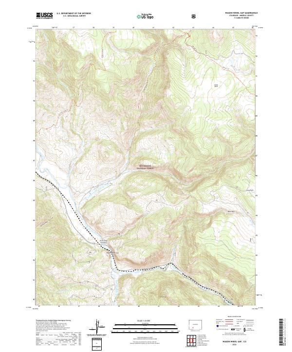
2022 Map of Wagon Wheel Gap
USGS Topo · Published 2022About this map
Wagon Wheel Gap serves as the focal point of this mountainous landscape where the Rio Grande winds through the southern reaches of the Rio Grande National Forest. The map illustrates the dramatic transition from the river valley to the high plateaus, marked by the striking Rio Grande Palisades and several high-altitude clearings such as Silver Park, Long Park, and Blue Park. A network of historic routes, including the Wheeler Trl and Farmers Creek Trl, suggests the area's long-standing importance for transalpine movement and forest management. The convergence of numerous drainages like Bellows Cr, Goose Creek, and McKinney Gulch defines the complex drainage pattern that has historically shaped both the geography and the accessibility of this corner of Mineral County.
Find a feature on this map
27 named features on this map. Tap any name to fly to it.
Don’t see what you’re looking for? This feature index may not catch every label — zoom into the map to look around manually.
Map Details
Editions of this 2022 Wagon Wheel Gap Map
This is the sole edition of this map. No revisions or reprints were ever made.
Other maps of this area

1914 · Creede
USGS Topo · 1:125,000

1916 · Creede
USGS Topo · 1:125,000

1945 · Durango
USGS Topo · 1:250,000

1953 · Durango
USGS Topo · 1:250,000

1954 · Durango
USGS Topo · 1:250,000

1957 · Spar City
USGS Topo · 1:62,500

1959 · Creede
USGS Topo · 1:62,500

1961 · Durango
USGS Topo · 1:250,000

1963 · Durango
USGS Topo · 1:250,000

1966 · Durango
USGS Topo · 1:250,000