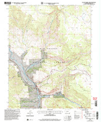
2001 Map of Wagon Wheel Gap
USGS Topo · Published 2005About this map
Rio Grande waters flow through this mountain landscape at the dawn of the twenty-first century, carving a path alongside the settlement of Wagon Wheel Gap. This territory is defined by the expansive Rio Grande National Forest, where a network of waterways including Farmers Creek, Bellows Creek, and Goose Creek descend from high-altitude features like Silver Park and Blue Park. The map documents localized history through landmarks such as a lonely Grave and a Gaging Station near the river, signaling the importance of water management in this high-country environment.
Find a feature on this map
28 named features on this map. Tap any name to fly to it.
Don’t see what you’re looking for? This feature index may not catch every label — zoom into the map to look around manually.
Map Details
Editions of this 2001 Wagon Wheel Gap Map
This is the sole edition of this map. No revisions or reprints were ever made.
Other maps of this area

1914 · Creede
USGS Topo · 1:125,000

1916 · Creede
USGS Topo · 1:125,000

1945 · Durango
USGS Topo · 1:250,000

1953 · Durango
USGS Topo · 1:250,000

1954 · Durango
USGS Topo · 1:250,000

1957 · Spar City
USGS Topo · 1:62,500

1959 · Creede
USGS Topo · 1:62,500

1961 · Durango
USGS Topo · 1:250,000

1963 · Durango
USGS Topo · 1:250,000

1966 · Durango
USGS Topo · 1:250,000