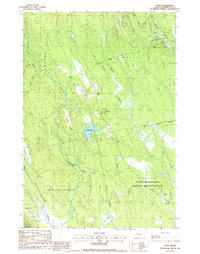
1988 Map of Waite
USGS Topo · Published 1988About this map
The town of Waite serves as the central hub of this late-1980s survey, situated along the edge of a landscape dominated by timber and water in Washington County. This region is characterized by an intricate drainage network where the Big Musquash Stream and its tributaries, such as the West Branch Big Musquash Stream, wind through the lowlands toward Patten Pond. The eastern portion of the quadrangle is largely occupied by the Indian Passamaquoddy Indian Reservation, showing the continued significance of indigenous land within the state’s interior. Local infrastructure is minimal, consisting of isolated settlements like Bingo and seasonal outposts like Roy Bailey Camp. High ground is defined by prominent peaks such as Neal Mtn and Mc Lain Mtn, while the presence of a Cem and multiple Sand & Gravel Pits point to the area’s local community history and resource extraction industry.
Find a feature on this map
28 named features on this map. Tap any name to fly to it.
Don’t see what you’re looking for? This feature index may not catch every label — zoom into the map to look around manually.
Map Details
Editions of this 1988 Waite Map
This is the sole edition of this map. No revisions or reprints were ever made.
Other maps of this area

1940 · Waite
USGS Topo · 1:62,500

1941 · Scraggly Lake
USGS Topo · 1:62,500

1941 · Big Lake
USGS Topo · 1:62,500

1941 · Wabassus Lake
USGS Topo · 1:62,500

1942 · Waite
USGS Topo · 1:62,500

1943 · Big Lake
USGS Topo · 1:62,500

1943 · Wabassus Lake
USGS Topo · 1:62,500

1944 · Scraggly Lake
USGS Topo · 1:62,500

1952 · Big Lake
USGS Topo · 1:50,000

1953 · Wabassus Lake
USGS Topo · 1:62,500