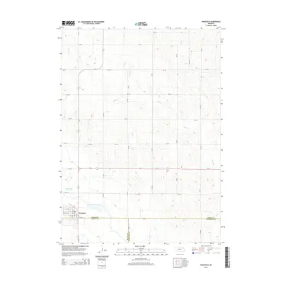
2014 Map of Wakefield
USGS Topo · Published 2014About this map
Wakefield sits at the convergence of Wayne and Dixon counties, serving as the primary hub for the surrounding agricultural landscape. The town's grid is well-defined by streets such as Main St and Winter ST, with a central Po serving the community. The area's complex hydrological history is visible in the relationship between the Old Channel Logan Creek and the engineered Logan Creek Dredge, which reflects efforts to manage the prairie waterways for farming.
Find a feature on this map
40 named features on this map. Tap any name to fly to it.
Don’t see what you’re looking for? This feature index may not catch every label — zoom into the map to look around manually.
Map Details
Editions of this 2014 Wakefield Map
This is the sole edition of this map. No revisions or reprints were ever made.
Other maps of this area

1955 · Sioux City
USGS Topo · 1:250,000

1958 · Sioux City
USGS Topo · 1:250,000

1959 · Sioux City
USGS Topo · 1:250,000

1966 · Altona NW
USGS Topo · 1:24,000

1966 · Thurston
USGS Topo · 1:24,000

1966 · Altona NE
USGS Topo · 1:24,000

1967 · Waterbury
USGS Topo · 1:24,000
1967 · Allen
USGS Topo · 1:24,000

1967 · Wakefield SW
USGS Topo · 1:24,000
1967 · Wakefield
USGS Topo · 1:24,000
Featured Places
- Wakefield, NE
- Springbank Township, NE
- Saint Johns Trailer Court, Wakefield
- Emerson Township, NE
- Wakefield Township, NE