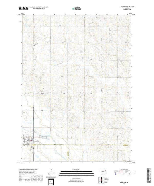
2021 Map of Wakefield
USGS Topo · Published 2021About this map
Wakefield sits at the intersection of three northeast Nebraska counties, serving as a hub for the surrounding agricultural landscape where Dixon, Wayne, and Thurston counties meet. The settlement is defined by a dense grid of residential streets like Michener St and Walnut St, flanked by the Logan Creek Dredge to the south. This modern survey illustrates the engineered water management of the region, showing the contrast between the straightened Logan Creek Dredge and the winding Old Channel Logan Creek. To the north, the terrain is carved by natural drainages including Middle Cr, Elk Cr, and Sand Cr. These waterways are surrounded by a systematic section-line road network, where routes like Ekberg Rd and 865 Rd provide access to the high ground between the creek valleys. The Wakefield Cem on the western edge of town remains a primary landmark for local genealogical research.
Find a feature on this map
42 named features on this map. Tap any name to fly to it.
Don’t see what you’re looking for? This feature index may not catch every label — zoom into the map to look around manually.
Map Details
Editions of this 2021 Wakefield Map
This is the sole edition of this map. No revisions or reprints were ever made.
Other maps of this area

1955 · Sioux City
USGS Topo · 1:250,000

1958 · Sioux City
USGS Topo · 1:250,000

1959 · Sioux City
USGS Topo · 1:250,000

1966 · Altona NW
USGS Topo · 1:24,000

1966 · Thurston
USGS Topo · 1:24,000

1966 · Altona NE
USGS Topo · 1:24,000

1967 · Waterbury
USGS Topo · 1:24,000
1967 · Allen
USGS Topo · 1:24,000

1967 · Wakefield SW
USGS Topo · 1:24,000
1967 · Wakefield
USGS Topo · 1:24,000
Featured Places
- Wakefield, NE
- Emerson Township, NE
- Wakefield Township, NE
- Springbank Township, NE
- Saint Johns Trailer Court, Wakefield