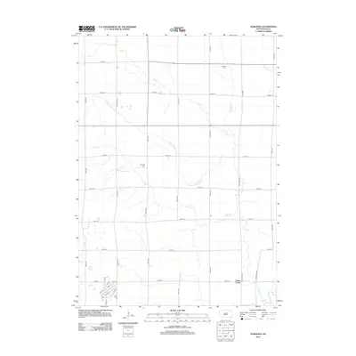
2012 Map of Wakonda
USGS Topo · Published 2012About this map
Frog Cr and its various tributaries wind through the agricultural landscape of Star Township in this 2012 survey of the Wakonda area. The land is defined by a strictly organized grid of range roads and section lines, interspersed with human-engineered water management systems like the Flynn Dickerson Ditch, Klepke Ditch, and Bonne Ditch. These features illustrate the intensive drainage efforts necessary to maintain the productive prairie farmland of southeastern South Dakota. Cultural markers and genealogical sites are scattered throughout the rural sections, including Holland Cem and Columkill Cem. In the southeastern corner, the Vermillion River meanders across the plain, while the local road network includes names reflecting heritage, such as Norwegian Ave.
Find a feature on this map
34 named features on this map. Tap any name to fly to it.
Don’t see what you’re looking for? This feature index may not catch every label — zoom into the map to look around manually.
Map Details
Editions of this 2012 Wakonda Map
This is the sole edition of this map. No revisions or reprints were ever made.
Other maps of this area

1897 · Canton
USGS Topo · 1:125,000

1898 · Parker
USGS Topo · 1:125,000

1898 · Elk Point
USGS Topo · 1:125,000

1900 · Canton
USGS Topo · 1:125,000

1901 · Elk Point
USGS Topo · 1:125,000

1907 · Elk Point
USGS Topo · 1:125,000

1955 · Sioux City
USGS Topo · 1:250,000

1955 · Sioux Falls
USGS Topo · 1:250,000

1957 · Gayville
USGS Topo · 1:24,000

1958 · Sioux City
USGS Topo · 1:250,000