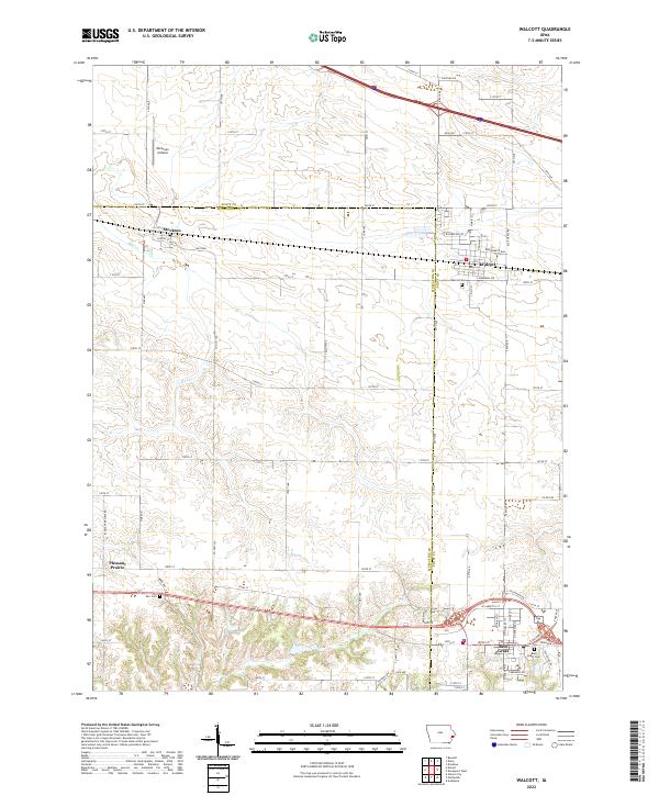
2022 Map of Walcott
USGS Topo · Published 2022About this map
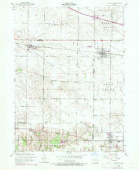
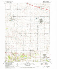
Walcott and Blue Grass anchor this modern-era survey of the rural landscape where Scott and Muscatine counties meet. The region is defined by its agricultural grid and the gentle drainages of Mud Creek and Duck Creek, which weave through the townships of T78N and T79N. Historically significant sites for genealogists include Walcott Cemetery, Parr Cemetery, and Blue Grass Cemetery, marking the resting places of the area's early farming families. A notable aviation landmark, Workman Airfield, sits just north of the rail corridor passing through Stockton. The transition from established town centers like Pleasant Prairie to the modern residential streets of Walcott, such as Brodenbeck Way and E Memorial Road, illustrates the ongoing balance between historical settlement patterns and recent growth near the Interstate 80 corridor.
Find a feature on this map
66 named features on this map. Tap any name to fly to it.
Don’t see what you’re looking for? This feature index may not catch every label — zoom into the map to look around manually.
Map Details
Editions of this 2022 Walcott Map
This is the sole edition of this map. No revisions or reprints were ever made.