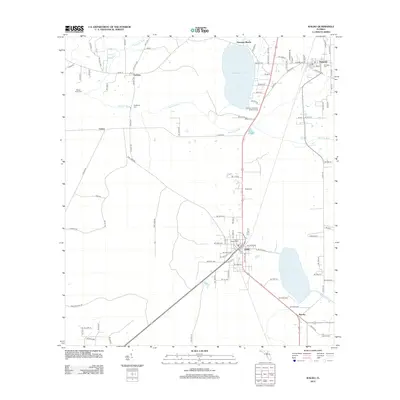
2012 Map of Waldo
USGS Topo · Published 2012About this map
The Santa Fe River and its various tributaries form a natural network across this Alachua County landscape, connecting water bodies like Hampton Lake and Lake Alto. The town of Waldo serves as a central hub, where the Waldo Canal and several major roads converge. The settlement pattern is characterized by several small communities, including Graham, Hampton, Louise, and Shenks, many of which are linked by historic routes such as Waldo Rd and Tree Farm Rd.
Find a feature on this map
97 named features on this map. Tap any name to fly to it.
Don’t see what you’re looking for? This feature index may not catch every label — zoom into the map to look around manually.
Map Details
Editions of this 2012 Waldo Map
This is the sole edition of this map. No revisions or reprints were ever made.
Other maps of this area

1890 · Arredondo
USGS Topo · 1:62,500

1892 · Arredondo
USGS Topo · 1:62,500

1894 · Arredondo
USGS Topo · 1:62,500

1938 · Hawthorn
USGS Topo · 1:48,000

1941 · Starke
USGS Topo · 1:62,500

1943 · Hawthorn
USGS Topo · 1:62,500

1948 · Starke
USGS Topo · 1:50,000

1949 · Sampson
USGS Topo · 1:24,000

1949 · Starke
USGS Topo · 1:24,000

1949 · Waldo
USGS Topo · 1:24,000