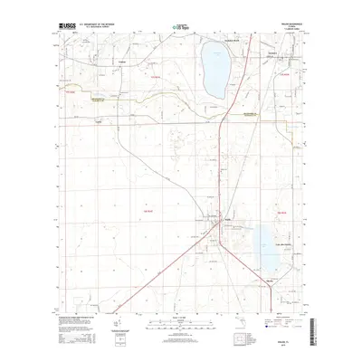
2015 Map of Waldo
USGS Topo · Published 2015About this map
The Santa Fe River meanders across the border of Bradford Co and Alachua Co, defining the northern reaches of this north-central Florida landscape. The town of Waldo serves as a central hub, where modern infrastructure meets the heritage of the Waldo Canal and the natural expanse of Lake Alto. This area is characterized by its numerous small burial grounds, including Laurel Grove Cem and Mount Sinai Cem, which offer significant points of interest for those researching local family lineages and pioneer history.
Find a feature on this map
95 named features on this map. Tap any name to fly to it.
Don’t see what you’re looking for? This feature index may not catch every label — zoom into the map to look around manually.
Map Details
Editions of this 2015 Waldo Map
This is the sole edition of this map. No revisions or reprints were ever made.
Other maps of this area

1890 · Arredondo
USGS Topo · 1:62,500

1892 · Arredondo
USGS Topo · 1:62,500

1894 · Arredondo
USGS Topo · 1:62,500

1938 · Hawthorn
USGS Topo · 1:48,000

1941 · Starke
USGS Topo · 1:62,500

1943 · Hawthorn
USGS Topo · 1:62,500

1948 · Starke
USGS Topo · 1:50,000

1949 · Sampson
USGS Topo · 1:24,000

1949 · Starke
USGS Topo · 1:24,000

1949 · Waldo
USGS Topo · 1:24,000