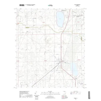
2018 Map of Waldo
USGS Topo · Published 2018About this map
Waldo and Hampton anchor this northern Florida landscape, where the Bradford Co Alachua Co boundary weaves through a complex network of wetlands and waterways. The town of Waldo serves as a local hub, situated at the junction of the Waldo Canal and significant rail infrastructure operated by CSX Transportation. This canal, along with the Santa Fe Canal, illustrates the historical efforts to manage water levels and navigation between Lake Alto and the surrounding marshlands like the Santa Fe Swamp. For genealogists, the map is particularly rich with burial sites, including Laurel Grove Cem, Sparkman Cem, and the Free Canaan Methodist Cem near Shenks. Smaller settlements such as Louise and Graham reflect the rural character of the region, while the Florida National Scenic Trail cuts through the northeast corner, following the edge of Hampton.
Find a feature on this map
104 named features on this map. Tap any name to fly to it.
Don’t see what you’re looking for? This feature index may not catch every label — zoom into the map to look around manually.
Map Details
Editions of this 2018 Waldo Map
This is the sole edition of this map. No revisions or reprints were ever made.
Other maps of this area

1890 · Arredondo
USGS Topo · 1:62,500

1892 · Arredondo
USGS Topo · 1:62,500

1894 · Arredondo
USGS Topo · 1:62,500

1938 · Hawthorn
USGS Topo · 1:48,000

1941 · Starke
USGS Topo · 1:62,500

1943 · Hawthorn
USGS Topo · 1:62,500

1948 · Starke
USGS Topo · 1:50,000

1949 · Sampson
USGS Topo · 1:24,000

1949 · Starke
USGS Topo · 1:24,000

1949 · Waldo
USGS Topo · 1:24,000