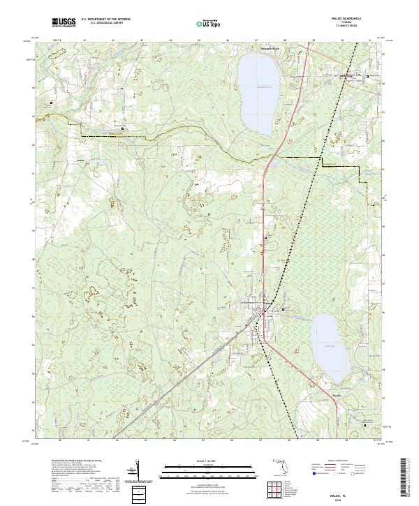
2024 Map of Waldo
USGS Topo · Published 2024About this map
Waldo serves as a central hub in this landscape where the boundaries of Bradford and Alachua counties meet. The area is defined by its significant water features, including the large expanse of Lake Alto and the nearby Hampton Lake, connected by the historic waterway of the Waldo Canal. To the north, the Sampson River and the Santa Fe River wind through the terrain, the latter disappearing into the dense Santa Fe Swamp. This modern survey documents the persistent settlement patterns of small communities like Hampton, Shenks, and Louise. Genealogists will find a high density of burial sites across the quadrangle, ranging from the Waldo Cem and Laurel Grove Cem in the south to the Sparkman Cem and Hampton Cem further north. The passage of the Florida National Scenic Trl through the northeastern corner highlights the region's role in modern recreational geography.
Find a feature on this map
91 named features on this map. Tap any name to fly to it.
Don’t see what you’re looking for? This feature index may not catch every label — zoom into the map to look around manually.
Map Details
Editions of this 2024 Waldo Map
This is the sole edition of this map. No revisions or reprints were ever made.
Other maps of this area

1890 · Arredondo
USGS Topo · 1:62,500

1892 · Arredondo
USGS Topo · 1:62,500

1894 · Arredondo
USGS Topo · 1:62,500

1938 · Hawthorn
USGS Topo · 1:48,000

1941 · Starke
USGS Topo · 1:62,500

1943 · Hawthorn
USGS Topo · 1:62,500

1948 · Starke
USGS Topo · 1:50,000

1949 · Sampson
USGS Topo · 1:24,000

1949 · Starke
USGS Topo · 1:24,000

1949 · Waldo
USGS Topo · 1:24,000