
1904 Map of Walker Creek
USGS Topo · Published 1904About this map
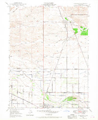
The eastern foothills of the Inner Coast Range take shape in this early century survey of Glenn County, where the drainage systems of Walker Cr and Wilson Creek dominate the landscape. Published as a Preliminary Edition based on 1904 fieldwork, the map captures a transition zone between the high relief of the west and the beginning of the Sacramento Valley floor. The terrain is defined by the branching tributaries of the North Fork Willow Cr, showing the complex network of seasonal watercourses like White Cabin Creek and the confluence of the North Fork and South Fork. The absence of established townsites emphasizes the area’s primary role in early California ranching and watershed management, providing a clear look at the township boundaries and topographical contours before modern development or intensive water engineering altered the natural flow of these creeks.
Find a feature on this map
8 named features on this map. Tap any name to fly to it.
Don’t see what you’re looking for? This feature index may not catch every label — zoom into the map to look around manually.
Map Details
Editions of this 1904 Walker Creek Map
This is the sole edition of this map. No revisions or reprints were ever made.
Other maps of this area

1904 · Vina
USGS Topo · 1:62,500

1906 · Willows
USGS Topo · 1:62,500

1914 · Kirkwood
USGS Topo · 1:31,680

1914 · Orland
USGS Topo · 1:31,680

1917 · Kurand
USGS Topo · 1:31,680

1917 · Lyman
USGS Topo · 1:31,680

1919 · Fruto
USGS Topo · 1:62,500

1944 · Fruto
USGS Topo · 1:62,500

1944 · Flournoy
USGS Topo · 1:62,500
1949 · Kirkwood
USGS Topo · 1:24,000