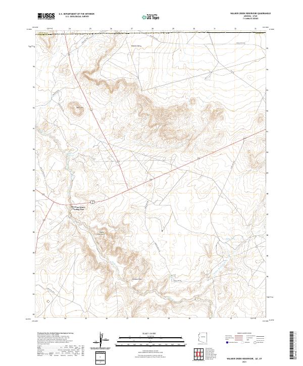
2021 Map of Walker Creek Reservoir
USGS Topo · Published 2021About this map
Mexican Water Trading Post stands as a primary landmark in this corner of the Navajo Nation, situated at a junction of roads near the Utah Arizona border. The landscape is defined by its dramatic geological formations and remote water sources, where the Walker Creek drainage system weaves through complex terrain. Notable natural features include the Walker Creek Arch and the prominent Window Rock formation, while high elevations like Gothic Mesa and the Nokaito Bench overlook the surrounding washes. This contemporary survey captures the area's essential hydrology and transit routes, from the Walker Cr Reservoir to the series of springs including Waterfall Spring and Willow Spring. The map documents the persistent network of tribal and county routes, such as Apache Co Rd C549, that connect these isolated water sources and geologic landmarks across the northern Apache County desert.
Find a feature on this map
21 named features on this map. Tap any name to fly to it.
Don’t see what you’re looking for? This feature index may not catch every label — zoom into the map to look around manually.
Map Details
Editions of this 2021 Walker Creek Reservoir Map
This is the sole edition of this map. No revisions or reprints were ever made.
Other maps of this area

1886 · Abajo
USGS Topo · 1:250,000

1892 · Abajo
USGS Topo · 1:250,000

1892 · Canyon De Chelly
USGS Topo · 1:250,000

1893 · Abajo
USGS Topo · 1:250,000

1953 · Dinne Mesa NW
USGS Topo · 1:24,000

1953 · Dinne Mesa SW
USGS Topo · 1:24,000

1953 · Toh-Atin Mesa
USGS Topo · 1:62,500

1954 · Shiprock
USGS Topo · 1:250,000

1956 · Cortez
USGS Topo · 1:250,000

1958 · Cortez
USGS Topo · 1:250,000
Featured Places
- Shiprock Agency
- Mexican Water Trading Post, Shiprock Agency
- Apache County, AZ
- San Juan County, UT
- United States